The little white label at the top of this map reads "Brule River outflow." For those who believe the Kensington Runestone and its message are authentic, this discharge of the Brule River into Lake Superior near Duluth may be marking the spot where ten Norsemen were assigned to wait and watch over the group's boat (or boats), now that westward sailing on Lake Superior was over. From now on, smaller boats would be in order...likely Native American birchbark canoes. The reduced group of twenty Norsemen, probably accompanied by Native Americans, would now proceed upstream, southward, toward the St. Croix River and a famous portage--the Brule-St. Croix portage. In part, one plaque at the portage reads:
"...a continental divide separates the watersheds of the Brule and St. Croix Rivers. The Brule flows north to Lake Superior and the St. Croix flows southerly to the Mississippi. A time worn trail connects the navigable portions of these two rivers."
Please note that I have taken the liberty of assuming that isostatic rebound in this specific region during the past several hundred years was likely not significant enough to have prevented this "time worn portage" from being used by the KRS team of adventurers. Generally speaking, isostatic rebound was greater going northward, where the ice was thicker.
Upon reaching the Mississippi, the men would turn to the right, northward, and travel a short distance to the Minnesota River. Here they began following the Minnesota River south and west, avoiding the Falls of St. Anthony (and portage) on the Mississippi.
Now, we should do some simple calculations and guesswork to see if we're in the ballpark for thinking that the KRS party may have come to Runestone Hill from Lake Superior rather than from Hudson Bay...although the latter is a popular viewpoint, too, thanks to H. Holand and his amazing King Magnus search party convictions. For me, it is simply a matter of believing that the group was traveling generally westward, from Vinland on America's East Coast, as the carved inscription indicates.
So, I am proposing fourteen days of travel by rivers, from the Brule River outflow at Lake Superior (where the ten men waited with a boat or boats) to Runestone Hill. Besides the single aforementioned portage, there is also the four-mile walk to Runestone Hill from the Chippewa River. But first, we must measure the approximate distance in miles, not just by days of travel. I have map-measured the entire waterway a few times and have come to believe that it is roughly four hundred miles.
I have purposely avoided figuring times or distances by "saltwater sailing" reckoning. In other words, I am going by how long it actually would take to travel the river-route, in real terms and conditions, not from open-water sailing calculations. Generally speaking, a person doesn't sail on rivers. Obviously, river travel can sometimes be quite slow, especially when traveling upstream, and usually, the larger the river, the easier and faster it is to paddle. As an example, it is much easier to paddle the Minnesota River than it is to paddle the St. Croix River, or the Chippewa River. Some days, many miles could be covered quite easily, and other days the pace might be painstakingly slow.
So, we must somehow come to a reasonable and agreeable average number of miles traveled in an average day of river traveling...for fourteen days, as the KRS stipulates. Covering roughly four hundred miles in fourteen days comes out to about twenty-eight miles per day. The question is, does this sound about right for theorizing that the KRS party may have arrived at Runestone Hill by way of the Great Lakes? Personally, I think an average of twenty-eight miles per day is within the range of good reasoning and guesswork. (I can only hope that you may agree.)
I guess someone--or a group of persons--could always reenact the canoe trip from the Brule River outflow to Runestone Hill, to see how long it would take. The St. Croix River is exceedingly beautiful and many people enjoy canoeing on it. The Minnesota River is a different story. Again, the reenactment group would simply be looking for a "ballpark guess-timate" that might possibly give some indication about whether the KRS party was likely to have come to Runestone Hill by way of Lake Superior, as the KRS inscription seems to be saying with the words: "...west from Vinland."
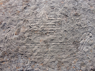
Norse Sailing Ship, Copper Harbor, Michigan, Lake Superior


Comments
Post a Comment